geology

Friday, 23 December 2011

VMS program in Sudan

VMS program same as in Sudan
Drilling at Hamama (VMS) Project in Egypt


* A favourable VMS horizon traced over a strike length of 3 km


* Historical shallow drilling shows widths of gossans up to 20 m


* Strong chargeability-magnetic anomaly indicates a second buried massive sulphide lens stratigraphically above the historical gossan outcrop zone.


* Deposit characteristics similar to other massive sulphide deposits in the Nubian Shield including:


o Nevsun, Bisha Deposit, Eritrea


o Tigray, Harvest Property; Ethiopia


o La Mancha, Hassai Deposit, Sudan


November 23, 2011 - Toronto, Ontario. Alexander Nubia International Inc. (TSX-V: AAN), an exploration and development company with diversified minerals projects in Egypt, is pleased to announce that it has commenced drilling at its Hamama zinc-gold-copper-silver property located in the Abu Marawat Concession. The Company plans to drill approximately
four to eight diamond drill holes for the first stage of drilling with results expected by Q1 2012.
Located 35 km WSW of the Abu Marawat property, Hamama, a volcanogenic massive sulphide deposit containing significant values of precious- and base-metals. The property has excellent new gravel road access from the paved Safaga-Qena highway. A historical drill intercept was reported by the previous operator Centamin Egypt (TSX:CEE) of 16 metres at 9.73% zinc, 1.16 g/t gold, 0.34% copper, 77.5 g/t silver and 0.62% lead (drilling by Minex, 1988-1989) combined with favorable geology that includes a strong vein and alteration stringer zone stratigraphically below the VMS.
President and CEO, A. Alexander Massoud commented, "The commencement of drilling at the Hamama Property is an important step towards unlocking the substantial value of the Abu Marawat Concession, which also hosts the Abu Marawat Property. We have been focused on completing our first NI 43-101 compliant resource statement on Abu Marawat and believe the successful results received to date merit the commencement of an exploration program at nearby Hamama. We are excited about the potential at the Hamama Property and believe that we are taking the right step towards creating shareholder value."
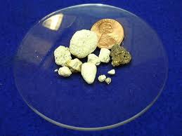
Table 1. Significant assay results from surface and old workings at Hamama Property
Au Ag Cu Zn Pb Rock type Width Sample type
(g/T) (g/T) % % % (cm)
9.7 173 0.7 4.43 gossan n.d. chip*
0.63 3.8 0.585 18.5 0.81 gossan 100 chip/channel
0.56 5.2 0.356 11.3 0.61 gossan 8 chip/channel
0.76 15.2 0.36 3.82 1.45 gossan 100 chip/channel
*Metal values are the maximum recorded for each element in a group of several 2-4 kg chip samples.

* A chip/channel sample consists of representative chips across the width of a structure or vein along a defined sample line (channel).
Abu Marawat gold-copper-zinc-silver project status
* AAM-081 concludes Stage 2 exploration at Abu Marawat. AAM-081, drilled from east of the CVZ on Section 500 is a step-out hole 100-m grid north from AAM-080.
* AAM-080 and AAM-081 are the two deepest drill holes on the property to-date, with drill lengths of 672 and 584 metres, respectively.
To date, the Company has completed 81 diamond drill holes at the Abu Marawat Property for a total of 17,972 metres. Results of the current drill program will be used to prepare a NI 43-101-compliant inferred resource. A complete set of published assay results and a detailed plan map are available at www.alexandernubia.com.
Qualifying Person
The technical information in this press release was prepared by Ralph Gonzalez (P. Geo), Project Manager for Alexander Nubia Inc., who manages the exploration program in Egypt. Mr. Gonzalez is a Qualifying Persons under National Instrument 43-101 regulations.


Thursday, 24 November 2011

Surpac software Design Open Pit


Open Pit Slope Stability Design Using Surpac & Slide:


How SNC Lavalin Put Technology To Work For Them

Nadine Miller is a Geotechnical Engineer-in-Training with SNC-Lavalin Engineers in Toronto, an active practitioner who is savvy about using the latest software to her advantage in her geotechnical practice. “In the past, I felt frustrated by the amount of time it takes to set-up a model prior running the analysis. I’m always on the look out for ways to improve my analyses and cut my modelling time.” On a recent project, Nadine decided that the best tools were two different, but complimentary software packages, Surpac and Slide: “Using these programs, I was able to more efficiently model and analyse open pit stability.” Here Nadine describes her open pit project and explains how she was able to create a successful final stability model that has been accepted by international and third party reviewers.

“Our project area was a small-scale open pit mine located in Europe. The project was at the basic engineering stage and there were plans to eventually do conventional open pit mining of four pits for precious metals. We collected information for the project from the site’s original geological and geomechanical reports, from data gathered in similarly mined galleries and from our investigations of the current pit. We were able to confirm what the old reports suggested, that the pit area was well drained by existing underground mine workings: the four pits are connected at the principal mine level, with groundwater draining out of one adit that daylights in a neighbouring valley. There were three main rock types found at the location: dacite (ore bearing), vent breccia and black breccia.” SNC Lavalin’s team undertook both geological and geomechanical exploratory drilling: “In our geological program, we drilled several hundred exploratory holes to allow us to define reserves and orebodies in our mining model and less than 10 holes for our geomechanical program.” Data from these drilling programs was used to develop a mining model and to assess the stability of each pit using Surpac and Slide, respectively.

During the geomechanical program, a unique weathering pattern in the black and vent breccias and the discovery that breccia encased the dacite formation led Nadine’s team to determine that breccia lay under the dacite pit walls. They used this data to assess failure possibilities and decided that circular type failure dangers existed in the breccias, because of their similarity to soil. For the benches composed of dacite, localized failure wedge/planar failure was considered. “We undertook highwall modelling for the circular sliding surface using circular failure with the known mechanical properties of the rockmasses. The dacite, with its similarity to hard fractured rock, was analyzed using Hoek-Brown criterion. Because of its soil-like qualities, the breccias were modelled using Mohr-Coulomb. Next, we assessed ground water conditions at the pits to incorporate into the model. Using Slide’s groundwater modeling module, we were able to incorporate drainage conditions from the four open pits and the derived boundary condition based on seepage analysis preformed in an adjoining valley.” It was assumed, based on the underground workings, in the groundwater model, that the periphery of the pit would be fully drained down to the principal mine level that connects all four pits: “The interior of the pit would be drained to the pit base through de-watering; boundary conditions were based upon watershed boundary conditions. After the groundwater model was run, the results established a future water table that was used for stability analysis.”

The initial evaluation of the open pit slope stability was based on simplified geological cross-sections from the geomechanical drilling program, simplified pit geometry and preliminary pit depths based on the feasibility study. One particular section, based on a single drillhole that intersected the overall slope of the feasibility pit shell, was entirely composed of black breccia. Once the maximum overall slope angle was assessed, the mine designers proceeded to develop their pit shells using Surpac: “During discussions with the designers, it became apparent that it was possible to select a cross-section of the natural ground surface and pit shell in Surpac and export it as file in DXF format. We could also export the geological data by including it in the cross-section. Using the two programs, we were able to evaluate a section based on a larger geological database, while still using our geomechanical parameters. This gave us the

flexibility to update our model to the most recent mine design and incorporate a larger database from which we could base our rock mass contacts, final pit shell geology and corresponding sub-surface geology with little to no additional time cost.” The team then re-analyzed the updated sections based on the complete Surpac model (Figure 1). Nadine adds that for the geomechanical parameters obtained during this program, factors of safety of the pit walls were computed using Bishop’s method. She says she expects that additional iterations will be required to verify the geological assumptions used in the pit slope stability analysis during the next stage of detailed design, the result of which could even further improve and optimize the overall pit slope configuration.

Southwest Open Pit 2Northeast

Future Water Table

Black Breccia

Vent Breccia

Dacite

Figure 1 Slide Model Geometry Imported as SURPAC DXF File

After hearing about SNC Lavalin’s technology forward approach to their project, we were curious: why did they decide to use Slide in combination with Surpac? “The primary reason we chose Slide is that it allows users to import geometry from programs such as AutoCad and Microstation using a DFX format. The second reason is that the automatic mesh generation feature in Slide’s groundwater modeling module saves a lot of time. By combining two powerful engineering software packages, our modeling set-up time was reduced significantly and we produced internationally accepted results.”

Friday, 11 November 2011

gold in sudan

Processing Gum Arabic


Introduction:

Gum Arabic is one of the most important cash-generating export crop in Sudan. It is one of the best of its type in the world. The project aims at processing gum Arabic, locally, to improve exports and benefit from the value-added.
- The sites producing gum Arabic in Sudan:

- Kordofan region 49.3%

- Kassala region 24.4%

- Darfur region 23.4 %

- White and Blue Nile region 2.9%

- The proposed sites for erecting the project:

Near the production collection regions.

- The productive capacity: 4000 tons per year.

- Methods of gum Arabic processing:

- The mechanical method.

- The method of sprinkle drying.

- The mechanical Method:

- Preliminary cleaning unit.

- Air cleaning and sorting unit

- Breaker.

- Refining mill and granules production mill.

- Conveyor belts.

- Packing unit with weighing machine.

- Quality control laboratory.

- Electrical control panel.

-The sprinkle Drying Method Equipment

- Dissolving container.

- Sifters with various openings.

- Sedimentation cylinder and the solution concentration cylinder.

- Drying and spraying unit.

- Cylinder drying unit.

- Solar energy unit for heating water.

- Cleaning and sorting unit.

- Quality control laboratory.

Area : Estimated at 800 m2 ; as follows:-

144 m2 Production hall.

280 m2 First cleaning shed.

48 m2 Second cleaning shed

250 m2 Stores

75 m2 Offices + utilities

Invested capital : US $ 6.628.032

Operating capital : US $ 192.247

Fixed Assets : US $ 150.735

Net profits : US $843.561

Profitability : 10 %


Period of Re-imbursement : 2 years


Raw Materials : gum Arabic – packing materials (Jute sacks)


Contact Address:


Investment Department,


Federal Ministry of Industry


Tel : 0249183777770


The Processing of Basic Chlorine


Introduction:


The Sudan is distinguished by its Red Sea shore, which provides salt. This encourage the establishment of a basic chlorine plant for the production of the following:-


- Caustic Soda: which is used in numerous industries, such as, textiles, industrial detergents, soap, edible oil refining and other industries which benefit from the characteristic of bleaching of the caustic soda.


- Chlorine: Which is used in many fields; such as, the water purifying and sterilization networks, the sewerage system networks and several other uses which benefit from the characteristic of chlorine as a disinfectant and insecticider.


- Hydrochloric acid (HCL): which is widely used as a multi-purpose acid. It is also used in large quantities for purifying the calcium carbonates from the bottom of oil wells and in petroleum refineries.


- Sodium hypochlorine: Which is used in the Weaving and spinning industry; and other purposes which benefit from its characteristic as a bleacher and pesticider.


- Productive capacity:


· Caustic soda 5 tons/day.


· Chlorine 5 tons/day.


· Hydrochloric acid 5 tons/day.


· Sodium Hypochlorine 5 tons/day.


- Invested capital US $ 2.700.000


- Raw materials:


- Sodium chloride.


- Phosphoric acid.


- Soda dust.


- Hydrochloric acid.


- Electricity.


- Man-power:


35 (direct and direct labour).


- Area of plant: 6560 m2.


- Location : It is preferred that the project shall be close to salt sources (i.e. Eastern Sudan.).


- Project’s Product users:


- Edible oil plants..


- Petroleum fields.


- Weaving and spinning plants.


- Water distribution networks.


- The average imported amounts during the last three years:-


2000 tons


- Contact Address:


The Investment Department,


Federal Ministry of Industry,


Tel: 0249 183 777770


Assembly and manufacture of


Solar Energy Equipments


Introduction:


God endowed the Sudan with a climate of less clouds and much sunshine throughout the year, therefore the Sudan is considered an ideal place for the system of transferring the light of the sun to electricity.


The Invested capital: 673653000 Sudanese Dinar


Machineries and Equipments:


- Assembly of Solar cells.


- Liquid batteries.


- Tools and Equipments.


Total cost of Machineries and Equipments:


122,000,000 Sudanese Dinar


Cost of raw materials for One Operational year:


150,000,000 Sudanese Dinar


Recovery Period: Two years


Contact Address:


Department of Investment ,


Federal Ministry of Industry


Tel: 0249183777770


Calcium Carbonate Manufacture


Introduction:


The lime stone is composed of the matter of calcium carbonate which could be grinded and purified for the extraction of pure powder of calcium carbonate, which is used in filling the plastic pipes and the plastic utensils, and also it is used in the production of insecticides and tooth paste, in addition to its use in cultivation and animal husbandry.


The proposed productive capacity: 20 ton/day.


The Investment Capital: 1,500,000 US Dollar.


The raw materials: Lime stone


The volume of employment: 450 direct and indirect employees.


The establishment area: The total area of the project is 35,000 m2.


The Location: It is preferable to establish the project near the areas where the raw materials are available and they are: Gabalain province, ‘Gabalain ‘town’ Atbara town, Sennar, Jabal Marra and any areas where the lime stone is discovered.


The Users of the Production:


- Plastic pipes production Factories.


- Plastic house utensils production Factories.


- Insecticides poweder production factories.


- Tooth paste production factories.


- The farmers.


Average of the Imported quantities during the last three years:214tons


Contact address: Investment Department:


The Federal Ministry of Industry,


Tel: 0249183777770


Concentrated Feed Manufacture


Introduction: The concentrated feed are protein and hydrocarbonic materials produced from the agricultural and processing remains and they wore divided into:


(a) Animal feed: They use the residues of legumes. Couch grass straw, Durra reeds, rice straw, residues of oil seeds like cotton seed, peanuts husks sesame sunflower, beans and the retuse of sugar factories such as Mollas, bugas and cane heads.


(b) Poultry feed: Contains fish powder, meat and bones powder and other animal remains like blood in addition to some materials used in Animal feed.


The targeted market: To cover the local market and exportation to the African and Arab countries.


The Productive capacity:


The proposed: 15,000 ton/year


The invested capital: estimated USD 1,550,000


The raw materials: Oil cake of cotton seed, wheat bran, bugas, Molas, pea-nuts husk, Dhura stalks, Calcium carbonates,


Table salt and vitamins.


The Premises area: 2200 m2


The Working force: 35 direct and indirect workers.


Average of imported quantities during the last three years:3503tons


Contact Address: Investment Department


Federal Ministry of Industry.


Tel : 0249183777770


Gold Processing Project


Umm Nyardi Mine


Location: North Wadi Half town


Annual Mining Capacity:


The Project target the mining and processing of 700 Kilograms annually.


Investment Costs: about USD 90 millions, Annual costs of production. USD 2.5 millions.


Annual Sales Returns: USD 7 million, net profits : USD 4.5millions.


Financial indicators: Net profits ratio to sales : 64%


Capital Recovery Period : about two years.


Contact Address: Investment Department


River Nile State


Tel : 0211822557


Glass Production Project


Location of the Project: Mattama Area


Mining capacity: 150 ton/per day


Project sales returns : Amounts to 17,4 million us Dollar.


Annual Production costs for the entire project:


Amounts to 9.1 million us Dollar


Financial indicators: Net profits ratio to the sales: 52%, Net profits ratio to the investment 37%


Capital recovery period: Two years


Contact Address: Investment Department


River Nile State.


Tel : 0211822557


Iron Extraction Project


The proposed Location: Bigrawiyya area


Raw materials: The raw iron belt which was formely expolcted by the pharaohs exist in the Bigrawiyya belt area with quantities not less than

750 million tons.


The targeted productive capacity: amounts to USD 100 millions.


Annual cost of production: amount to USD 362 million


Sales returns: amounts to USD 550 million


Annual net profits: amount to USD 100 million.


Financial indicators:


Net profits ratio to Sales : 34%


Net profits ratio to investment : 100%


Capital recovery period: One year


Relative advantages of the project: Electricity is considered the principal element in the costs of production as the project needs annually 3000 megawatt/hour.


The establishment of Kajbar reservoir will make available the electrical energy to this project.


Note: The establishment of the project requires the execution of geological surveys to determine the reserve volume.


Contact Address: Investment Department,


River Nile State:


Tel : 0211822557


Ceramic and Porcelain Production Project


Location of the project: South Matamma.


The targeted productive capacity:


The project aims to produce 3,000 m2 annually.


Cost of Investment: The volume of the required investment is estimated around 31,7 millions US Dollar.


The return of the project’s annual sales: 63 million US Dollar.


Costs of Production: A sum of 48,9 million US Dollar.


Annual net profits: 14.1 million US Dollar.


Financial indicators:


Net profits ratio to sales : 17.4


Net profit ratio to investments : 32.2%.


Internal return average : 39.6%


Capital Recovery Period: 3 years


Contact Address: Investment Department


River Nile State,


Tel: 0211822557


Cement Production Project


The proposed Location: Five factories will be established as follows:


· Two factories in west Berber area.


· One factory in Abu Hamad area.


· One factory in Ebiediyya area.


· One factory in Atbara town.


The designed productive capacity for each project:


Each project aims to produce 325,000 ton cement/year.


Investment for each project:


The Total investment cost: 55,1 million US Dollars.


The annual project sales, ‘ for each project’.


The project gross return when it works with full capacity:


29.2 million US Dollar.


Annual cost of production: 10.2 US Dollar.


Annual total profit for the project : 19 million US Dollar


Financial Indicators:


Net profits ratio to the Sales = 65%


Net profits ratio to the investment = 35%


Period of capital Recovery: Three year


Contact Address : Investment Department,


River Nile State


Tel : 0211822557


Mica Production Project


Location of Project: El-Shriek – River Nile State


Targeted productive capacity : 200 ton/day.


Investment Costs : 2.5 million US Dollar.


Annual Sales return : 1.2 million US Dollar


Costs of Production: 0.6 million US Dollar.


Net profits ratio to the Sales = 34%


Net profits ratio to the investment = 100%


Capital recovery period: 3 years


Contact Address : Department of Investment


River Nile State


Tel : 0211822557


http://www.sudaninvest.org/English/Projects-Industry.htm

investment the gold in Sudan

The possibility of  investment the gold in Sudan

Sudan issues 50 more gold exploration licenses
Sudan's govt. has issued 50 licenses to 73 firms to explore gold and other minerals, as it tries to grow its small gold production to compensate for the loss of most of its oil reserves to newly independent South Sudan.

Posted: Monday , 31 Oct 2011
KHARTOUM (Reuters) -
African gold producer Sudan has handed out 50 more licenses to 73 firms to explore gold and other minerals, state news agency SUNA said on Sunday.

Sudan is trying to expand its small gold production to compensate for the loss of most of its oil reserves to South Sudan which became independent in July.

The new licenses allow gold exploration in around eleven states, Minerals Minister Abdelbagi Gailani Ahmed told SUNA, adding that now seven firms were producing gold. The rest is still at the exploration stage.
To date, Sudan has handed out around 200 gold exploration licenses.
Ahmed reiterated Sudan would build at the start of next year a refinery with capacity of 150 tonnes of gold and 30 tonnes of silver.
In total, Sudan expects to produce about 70 tonnes of gold in 2011, he said. Only an estimated 6 to 7 tonnes gold will come from regular mines. The rest is being produced by more than 200,000 local Sudanese attracted by a gold rush whose exact output is hard to verify

Wednesday, 21 September 2011

Terminology


Terminology for geology


lava


Magma poured out on surface of earth or rock solidified from such magma

magma

1- Naturally occurring silicate melt, which may contain suspended silicate crystals, dissolved gases, or both. These conditions may be met in general by a mixture containing as much as 65 percent crystals but no more than 11 percent dissolved gases.

2- Naturally occurring molten rock, generated within the Earth and capable of intrusion and extrusion, from which igneous rocks are derived through solidification and related processes. It may or may not contain suspended solids (such as crystals and rock fragments) and/or gas phases. Adj: magmatic. AGI

a channel

A narrow, sinuous channel in which a lava river moves downward and away from a central vent or fissure to feed an aa flow. At the end of eruptive activity, the lava river ordinarily drains away, leaving an open channel mostly floored with spinose aa

abyssal theory

A theory of mineral-deposit formation involving the separation and sinking of ore minerals below a silicate shell during the cooling of the Earth from a liquid stage, followed by their transport to and deposition in the crust as it was fractured (Shand, 1947). Modern thought ascribes more complex origins to mineral deposits. AGI


a axis


a. One of the three crystallographic axes used as reference in crystal description. It is oriented horizontally, front to back. b. One of the three reference axes used in describing a rock fabric possessing monoclinic symmetry, such as progressive simple shear. The a axis is the direction of tectonic transport, i.e., the direction of shear. Syn: a direction CF: b axis; c axis


a direction

See: a axis

abyssal injection

The process by which magmas, originating at considerable depths, are considered to have been driven up through deep-seated contraction fissures

active mining area

a. The area, on and beneath land, used or disturbed in activity related to the extraction, removal, or recovery of coal from its natural deposits. This term excludes coal preparation plants, areas associated with coal preparation plants, and post-mining areas. SME, 1


b. The area in which active mining takes place relative also to extraction of metal ores, industrial minerals, and other minerals of economic value


aerial mapping


The taking of aerial photographs for making maps and for geologic interpretation. AGI


Babel quartz

A variety of quartz, named for the fancied resemblance of the crystal to the successive tiers of the Tower of Babel. Syn: Babylonian quartz


banded quartz-hematite ore

Braz. In the Itabira Region of Minas Gerais, schistose, specular hematite forming alternate bands with sugary quartz. Some of the beds are auriferous and contain gold-palladium alloys with manganese oxides, native copper, and talc. Writers have given the rocks various names, such as iron-glance schist, jacutinga, quartz itabirite, and bandererz. Hess


base map

a. A map on which information may be placed for purposes of comparison or geographical correlation. Base map was at one time applied to a class of maps now known as outline maps. It may be applied to topographic maps, also termed "mother maps," that are used in the construction of many types of maps by the addition of particular data. AGI


b. A map of any kind showing essential outlines necessary for adequate geographic reference, on which additional or specialized information is plotted for a particular purpose; esp. a topographic map on which geologic information is recorded. AGI


black copper ore


An earthy, black, massive, or scaley form of copper oxide, CuO. See also: melaconite; tenorite. Hess


black gold

a. A slang American term referring to crude oil.


b. Syn: Maldonite


c. Placer gold coated with a black or dark-brown substance (such as a film of manganese oxide) so that the yellow color is not visible until the coating is removed. AGI

black mica

See: biotite

blue gold

a. A gold-iron alloy containing 25% to 33.3% iron. Camm


b. A bluish collodial solution of gold prepared by reducing a solution of gold chloride with hydrazine hydrate. Camm


blue ironstone

A bluish iron-bearing mineral; specif: crocidolite and vivianite.


chert

Granular cryptocrystalline silica, similar to flint but usually light in color. Occurs as compact

massive rock or as nodules

clastic rock

A consolidated sedimentary rock composed principally of broken fragments that are derived from preexisting rocks (of any origin) or from the solid products formed during chemical weathering of such rocks, and that have been transported mechanically to their places of deposition; e.g., a sandstone, conglomerate, or shale; or a limestone consisting of particles derived from a preexisting limestone. Syn: fragmental rock; clasolite. AGI


collapse breccia

A breccia formed by the collapse of rock overlying an opening, as by foundering of the roof of a cave or of the roof of country rock above an intrusion; e.g., a solution breccia. Syn: founder breccia


copper

a. A reddish metallic element that takes on a bright metallic luster and is malleable, ductile, and a good conductor of heat and electricity. Symbol, Cu. Occasionally occurs native, and is found in many minerals such as cuprite, malachite, azurite, chalcopyrite, and bornite. Its alloys, brass and bronze, are very important; U.S. coins are now copper alloys. Its oxides and sulfates are used as an agricultural poison and as an algicide in water purification. Handbook of Chemistry and Physics, 3


b. An isometric native metal Cu ; metallic, red, soft, ductile and malleable; sp gr, 8.9; in oxidized zones of copper deposits, formerly a major source of native copper; the only native metal to occur abundantly in large masses; commonly occurs in dendritic clusters or mossy aggregates, sheets, or in plates filling narrow cracks or fissures. See also: native copper


core drilling

a. The process of obtaining cylindrical rock samples by means of annular-shaped rock-cutting bits rotated by a borehole-drilling machine. Long


b. Drilling with a hollow bit and a core barrel to obtain a rock core.

cross section

a. A diagram or drawing that shows features transected by a given plane; specif. a vertical section drawn at right angles to the longer axis of a geologic feature, such as the trend of an orebody. AGI


b. An actual exposure or cut that shows transected geologic features.--Adj: cross-sectional. Also spelled: cross-section. AGI


c. A profile portraying an interpretation of a vertical section of the Earth explored by geophysical and/or geological methods.


d. A horizontal grid system laid out on the ground for determining contours, quantities of earthwork, etc., by means of elevations of the grid points. Seelye, 2

cross-bedded

Having minor beds or laminae inclined to the main planes of stratification, e.g., cross-bedded sandstone.

cross-sectional area

The area of a surface cut by a plane passing through the body and perpendicular to the long axis of the body if one exists. If not, any such area cut by a plane

crusher rock

a. Term used in quarrying to describe the weathered overlying rock that occurs at most quarry operations and which is sold for use as road base.


b. The total unscreened product of a stone crusher. Shell


dam


a. A barrier to keep foul air or water, from mine workings. See also: stopping; bulkhead. Fay


b. An airtight barrier to isolate underground workings that are on fire. CTD


c. The wall of refractory material, forming the front of the forehearth of a blast furnace, that is built on the inside of a supporting iron plate (dam plate). Iron is tapped through a hole in the dam, and cinder through a notch in the top of the dam. See also: Lurmann front


deformation of rocks

Any change in original shape or volume of rock masses; produced by mountain-building forces. Folding, faulting, and plastic flow are common modes of rock deformation

desert

A region with an average annual rainfall of 10 inches or less and sparse vegetation, typically having thin, dry, and crumbly soil. A desert has an aridity index greater than 4.0.

diamond

A mineral composed of elemental carbon; hardest substance known. Used as a gem and, in industry, for cutting tools.


digger


a. One that digs in the ground, as a miner or a tool for digging. Webster 3rd


b. A worker who is paid by the ton for coal produced; a miner in the stricter sense. Originally the digger mined or undermined the coal; now the term is applied to the worker who merely shoots out the coal. Fay


c. A machine for removing coal from the bed of streams, the coal having washed down from collieries of culm banks above. Zern


dolomite


Mineral composed of carbonate of calcium and magnesium, CaMg(CO3)2. Also used as rock name for formations composed largely of mineral dolomite.

earthy breccia

A breccia in which rubble, sand, and silt plus clay each constitute more than 10% of the rock. AGI

fault

Surface of rock rupture along which has been differential movement.


fold

Bend, flexure, or wrinkle in rock produced when rock was in a plastic state.


fault-fold

A structure that is associated with a combination of folding and nearly vertical faulting, in which crustal material that has been fractured into elongate strips tends to drape over the uplifted areas to resemble anticlines and to crumple into the downthrown areas to resemble synclines. AGI

fossil

Evidence of past life, such as dinosaur bones, ancient clam shell, footprint of long-extinct animal, or impression of leaf in rock

fraction

A portion of an unconsolidated sediment or of a crushed consolidated rock sample or of a crushed ore or mineral sample that has been separated by some method, and is distinguished in some manner from all the other portions (or fractions) comprising the whole sample being analyzed. Also a fraction may be separated and defined on the basis of its mineral content, its specific gravity or density, its magnetism or lack of magnetism, or its solubility or insolubility in acid.

geology

Organized body of knowledge about the earth, including physical geology and historical geology, among others.


geologic-time scale

Chronological sequence of units of earth time.

geophysics

Physics of the earth

geosyncline

Literally, "earth syncline." Term now refers, however, to a basin in which thousands of meters of sediments have accumulated, with accompanying progressive sinking of basin floor explained only in part by load of sediments. Common usage includes both accumulated sediments themselves and geometrical form of basin in which they are deposited. All folded mountain ranges were built from geosynclines, but not all geosynclines have become mountain ranges.

geochronology

The study of the relationship between the history of the Earth and time.


geothermal field

Area where wells drilled to obtain elements contained in solution in hot brines and to tap heat energy.

GIS

See: Geographic Information System


gneiss

Metamorphic rock with gneissic cleavage. Commonly formed by metamorphism of granite

gold

a. An isometric mineral, native 4[Au] ; commonly alloyed with silver or copper, possibly with bismuth, mercury, or the platinum-group metals; metallic yellow; soft and malleable; sp gr, 19.3 if pure; occurs in hydrothermal veins with quartz and various sulfides; disseminated in submarine massive effusives and in placers or nuggets, fines, and dust. b. Found in nature as the free metal and in tellurides; very widely distributed. Symbol: Au. Occurs in veins and alluvial deposits; often separated from rocks and other minerals by sluicing and panning operations. Good conductor of heat and electricity. Used in coinage, jewelry, decoration, dental work, plating, and for coating certain space satellites. It is a standard for monetary systems in many countries. Syn: palladium gold


gold amalgam

Former spelling of goldamalgam. See also: amalgam


gold quartz


Milky quartz containing small inclusions of gold; may be cut and polished for jewelry. Syn: gold matrix


gravel mine


S. Afr. A mine extracting gold from sand or gravel; also called placer mine. See also: gravel pit


Sunday, 11 September 2011

المصطلحات الجيلوجيا

المصطلحات العلمية في الجيولوجيا


1. (علم الجيولوجيا ) علم يختص بالبحث في كل شيء يتعلق بالأرض.

2. (الجيولوجيا الكونية ) أحد فروع الجيولوجيا يختص بدراسة أصل الأرض وصلتها بالأجرام السماوية.

3. (الجيولوجيا التركيبية ) علم يختص بدراسة بناء الكتل الصخرية وتصدع القشرة الأرضية

4. (وصف الطبقات ) علم يبحث في تتابع طبقات الصخور وترتيبها في نظام زمني.

5. (الجيولوجيا الهندسية )علم يهتم بدراسة الخواص الميكانيكية والهندسية للصخور.

6. ( الاستشعار عن بعد ) علم يختص بدراسة واستخدام صور المركبات الفضائية والأقمار الصناعية.

7. (جيولوجيا البحار ) علم يعطي معلومات عن البحار والرسوبيات والصخور التي تكون قاع البحر.

8. ( الجيو كيمياء ) علم يهتم بدراسة توزيع العناصر المختلفة في القشرة الأرضية.

9. ( الكون ) كل ما خلقه الله مرئيا كان أم غير مرئي .

10. ( المجرة ) نظام نجمي يتكون من آلاف ملايين النجوم والسدم.

11. (المجموعة الشمسية ) نظام نجمي فريد يتكون من نجم واحد هو الشمس وتسعة كواكب.

12. ( الأقمار ) كواكب صغيرة تخضع لجاذبية كواكب أكبر منها وتدور حولها.

13. ( الكويكبات ) وهي كتل صخرية متفاوتة الحجم تدور ما بين المريخ والمشتري.

14. ( الشهب)بقايا كويكبات تحترق بصورة كاملة أثناء احتكاكها بالغلاف الجوي.

15. ( النيازك ) بقايا كويكبات تحترق بصورة جزئية وتسقط على الأرض.

16. ( المذنبات ) كتل من الثلج وغازات متجمدة وقطع من الصخور.

17. ( السديم ) مادة أولية عبارة عن كتل غازية وغبارية نشأ منها الكون.

18. ( التمايز الكيميائي ) هبوط العناصر الثقيلة وطفو المكونات الخفيفة.

19. ( اللب الداخلي ) أحد مكونات الكتلة الصلبة للأرض غني بالحديد والنيكل.

20. ( الوشاح ) نطاق صخري ترتفع درجة حرارته كلما تعمقنا فيه.

21. ( اللب الخارجي ) نطاق فلزي مصهور من ضمن مكونات الكتلة الصلبة للأرض.

22. ( الغلاف الجوي ) جزء من كوكب الأرض يحمينا من أشعة الشمس الحارقة والإشعاعات الخطيرة.

23. ( الغلاف المائي) كتلة ديناميكية من الماء في حركة مستمرة من البحار والمحيطات.

24. ( القشرة القارية ) تماثل في تركيبها صخر الجرانيت وتسمى السيال.

25. ( القشرة المحيطة ) تماثل في تركيبها صخر البازلت وتسمى السيما.

26. ( الحيود المحيطية ) سلاسل جبلية عالية تقع في منتصف المحيطات.

27. ( الخنادق أو الأغوار ) تجاويف عميقة جدا في قاع المحيطات تكون مقوسة الشكل عادة.

28. ( الماجما ) الصهير الذي نشأت من الصخور النارية بأنواعها.

29.( اللافا ) هي الماجما بعد خروجها على سطح الأرض وفقدانها للغازات.

30. ( التعرية ) تفتيت الصخور وتحليلها ثم نقل النواتج إلى أماكن أخرى.

31. ( التجوية ) تفتيت الصخور وتحليلها بواسطة الجوية السائدة في الغلافين الجوي والمائي.

32. ( الحدود المتباعدة ) هي نطاقات تبتعد فيها الألواح عن بعضها تاركة فراغ فيما بينها.

33. ( الإندساس ) مناطق يتم فيها ابتلاع اللوح المحيطي.

34. ( الحدود المتقاربة ) نطاقات تقترب فيها الألواح من بعضها.

35. ( صخور الأوفيولايت ) تنشأ نتيجة انزلاق شرائح من القشرة المحيطة فوق الجزء القارى.

36. ( حدود الصدوع الناقلة ) نطاقات تحدث فيها زحزحة للألواح بالنسبة لبعضها البعض في اتجاهات أفقية ولكن متضادة.

37. ( البراكين ) تراكمات من اللافا على سطح القشرة الأرضية وتصلبها بحيث تكون قبابا أو جبالا مميزة.

38. ( طفوح اللافا )تتميز بإنخفاض نسبة السليكا مما يجعل درجة لزوجتها منخفضة وقدرتها على الحركة والإنسياب لمسافات كبيرة.

39. ( المواد الفتاتية البركانية ) مواد مقذوفة بجانب قصبة البركان مكونة تركيب مخروطي وتختلف في أحجامها.

40. ( القصبة ) وهي أنبوب أسفل فوهة البركان .

41.( المخروط ) جبل أو قبة من المواد المنصهرة التي قذفها البركان.

42. ( براكين درعية ) طفوح بازلتيه ونسبة قليلة من المواد الفتاتية وتأخذ شكل تركيب قبوي ذو انحدار لطيف.

43.( براكين المخاريط الفتاتية ) فتات بركاني مقذوف تتميز بالإنحدار الشديد.

44. ( طفوح الشقوق ) كميات كبيرة من المواد البركانية تخرج من الشقوق والكسور في القشرة الأرضية.

45.( النقاط الساخنة ) نقاط تتصاعد منها الماجما خلال اللوح الى سطح الأرض.

46. ( الزلازل ) حركات أرضية سريعة تنتاب القشرة الأرضية في فترات متقطعة ومرات عديدة.

47. ( زلازل ضحله ) نوع من الزلازل يحدث بالقرب من سطح الأرض وحتى عمق 33كم .

48. ( السيزموجراف ) جهاز يستخدم لتسجيل الزلازل من حيث شدتها ووقت حدوثها

49)علم البلورات crystallography
علم يدرس ترتيب الذرات في المواد الصلبة , ذلك أن معظم المعادن المكونة للقشرة الأرضية عبارة عن مواد صلبة متبلورة .

50)علم البيئة القديمة paleoecology
وهو يختص بتحديد البيئات التي كانت تعيش فيها الكائنات الحية في الفترات المختلفة من تاريخ الأرض . ويمكن اعتبار هذا العلم امتداد لعلم الحفريات.

51)علم المعادن mineralogy
علم يدرس المعادن وطرق الكشف عنها وتكوينها

52)علم الصخور petrology
وهو يختص بدراسة الصخور التي تتكون من معادن .
ولهذا العلم جانبان : أحدهما وصفي , والغرض منه معرفة الصخور وتصنيفها. وهو علم وصف الصخور petrography , أما الثاني فهو تفسيري ويختص بنشأة الصخور

53)علم الجيولوجيا التركيبية structural geology
وهو يهتم بالتراكيب الجيولوجية الناتجة عن الحركات الأرضية , ويقوم بوصف وتصنيف هذه التراكيب ودراسة نشأتها .

54)علم الحركات الأرضية أو الجيوتكتونيا geotectonics
وهو يهتم بدراسة تطور التراكيب الجيولوجية وعلاقتها بعمليات الترسيب , ويتضمن هذا العلم أيضا نظرة تاريخية إلى تطور التركيب الجيولوجية , لذلك فهو يعتمد على الجيولو جيا التاريخية .


55)علم الحفريات أو الباليونتوجيا paleontology
وهو يختص بدراسة الحفريات أي بقايا الكائنات الحية في الصخور الطبقية .

56)علم الطبقات stratigraphy
وهو يقوم بتصنيف طبقات الأرض المتكونة من صخور طبقية من حيث صفاتها الصخرية ومحتوياتها الحفرية وتاريخ وظروف تكوينها .


57)الجيولوجيا التاريخية historical geology
هذا العلم يقوم بربط المعلومات التي تجمعها كل العلوم الخاصة بالأرض لفهم تاريخ تطور القشرة الأرضية من حيث التغيرات الجغرافية والتركيبية (الحركات الأرضية) والمناخية والبيولوجية .

58)الجيولوجيا الاقتصادية economic geology
وهو علم يسعى إلى دراسة المعادن التي لها أهمية اقتصادية , وهدف هذه الدراسات ايجاد مبادئ للتنقيب عن هذه المعادن ولتقويمها تقويما اقتصاديا

59)الجيولوجيا الهندسية engineering geology
يتضمن هذا العلم دراسة الخواص الميكانيكية و الهندسية للصخور من أجل إقامة المنشآت الهندسية المختلفة كالمباني الضخمة والأنفاق والجسور والسدود والآبار وغيرها


60)جيولوجيا النفط petroleum geology
يتضمن الطرق المتعددة للتنقيب عن النفط , ويعتمد هذا العلم على علم الطبقات والجيولوجيا التركيبية

61)جيولوجيا المياه hydrology
يتضمن هذا العلم الطرق المتعددة للبحث عن المياه الجوفية , ولتقويم الأجسام المائية السطحية وتحت السطحية للاستفادة منها .

62)جيولوجيا المناجم mining geology
وهي تتضمن طرق حفر المناجم في الأجسام المعدنية الاقتصادية المختلفة

Tuesday, 16 August 2011

Mineral Photos - Phosphate Rock


Background

Phosphate rock is used for its phosphorus content. Hennig Brand discovered the element phosphorus in 1669. He prepared it in a set of experiments on urine; each experiment used at least 50 to 60 buckets! Phosphorus is a very important piece of the DNA and RNA molecules of which all life is formed. It is also important for the development of teeth and bones. The name phosphorus comes from the Greek word phosphoros, which means bringer of light. Phosphorus is mined in the form of phosphate rock.


Phosphate rock is formed in oceans in the form of calcium phosphate, called phosphorite. It is deposited in extensive layers that cover thousands of square miles. Originally, the element phosphorus is dissolved from rocks. Some of this phosphorus goes into the soil where plants absorb it; some is carried by streams to the oceans. In the oceans the phosphorus is precipitated by organisms and sometimes by chemical reaction. Phosphorus-rich sediments alternate with other sediments (geologists say these beds are interstratified). Phosphorus-rich beds usually have very few fossils; however, deposits in Florida and North Carolina contain a large amount of marine fossils. Some geologists believe that the formation of these phosphorus layers occur under a very special condition in which no other type of sediment is present. In addition, it is believed that phosphorus-rich rock is deposited in a body of water in which there is no oxygen; this is called an anaerobic environment. Many theories say that phosphorus is absorbed by ocean plants that die. As they decompose, the phosphorus accumulates. Despite many theories, studies about the formation of phosphate rock continue and theories about its deposition are developing.


In addition to the sedimentary phosphate deposits, there are some igneous rocks that are also rich in phosphate minerals. Sedimentary phosphate deposits, however, are more plentiful.


Sources

Large deposits of phosphate from igneous rock are found in Canada, Russia, and South Africa. Deep-sea exploration of the world’s oceans has revealed that there are large deposits of phosphates on the continental shelf and on seamounts in the Atlantic and Pacific Oceans. Recovering these deposits, however, is still too expensive, so they remain untouched for now. In the United States, phosphate rock is mined in Florida, North Carolina, Utah and Idaho. Florida and North Carolina account for approximately 85% of phosphate rock production in the United States. U.S. companies export large quantities of phosphate fertilizers all over the world. Phosphate rock is imported to the United States as well. Nearly all of these imports come from Morocco, a major supplier of phosphate rock to the world.


Uses

Some phosphate rock is processed to recover elemental phosphorus. Pure phosphorus is used to make chemicals for use in industry.


The most important use of phosphate rock, though, is in the production of phosphate fertilizers for agriculture. Some is used to make calcium phosphate nutritional supplements for animals.


Substitutes and Alternative Sources

Phosphorus is so important to life, that there is no substitute for it in agriculture. As for alternative sources, the phosphorus deposits on the ocean floor may one day be recovered when a profitable method of deep ocean mining is developed.